|
Dowlais |
|
Merthyr Tydfil |
|
|
|
|
 |
|
| |
|
<Click on the
photograph to see a larger version> |
| |
|
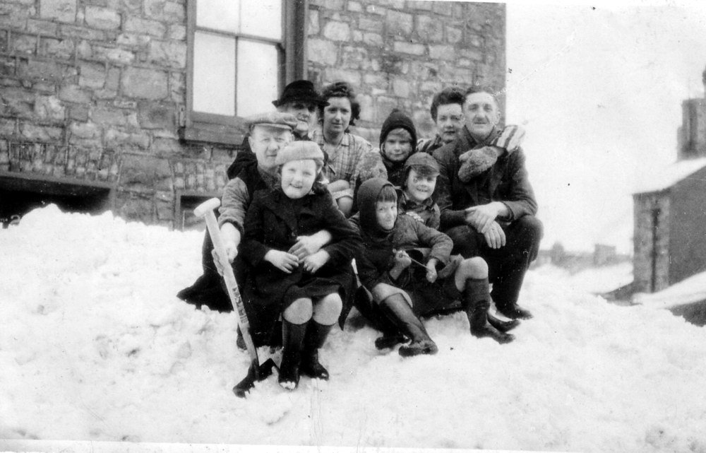
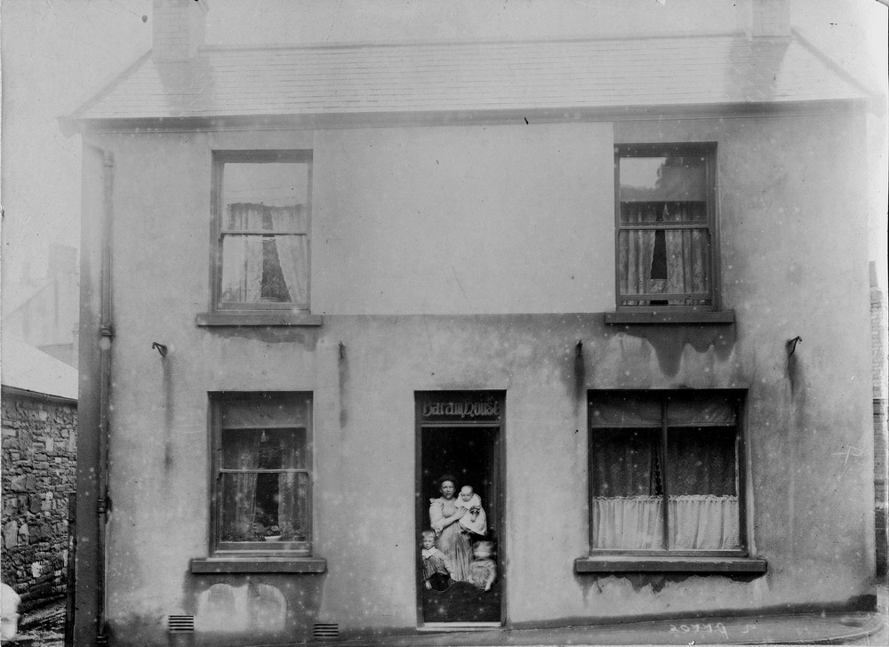
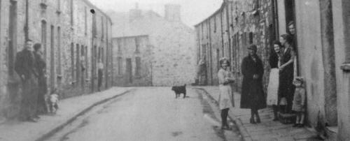
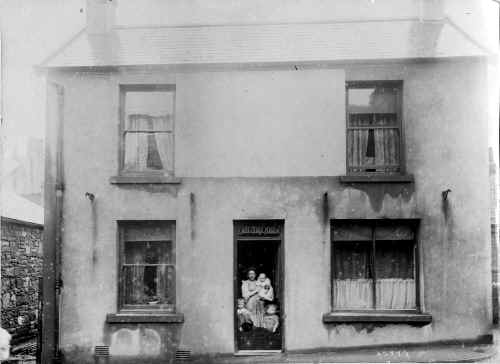
Alma Street. - In
the winter of 1947
Outside No 26 Alma
Street The lady with the black hat is
Elizabeth Jones and the lady next to her is her daughter
Margaret Griffiths.(nee Jones).
(Photograph
and information courtesy of Valerie Griffiths) |
|
 |
| |
| Alma Street. |
|
 |
| |
|
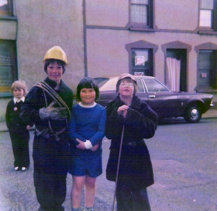
Broad Street - Silver Jubilee
1977
L-R: Mark
Rees, Steven Griffin & Phillip Rees.
(Photograph
Courtesy of Steven Griffin) |
|
 |
| |
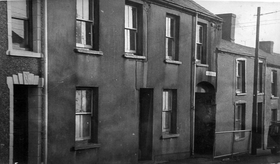
| Sand Street - Dowlais |
|
 |
| |
| Sand Street - Dowlais |
|
 |
| |
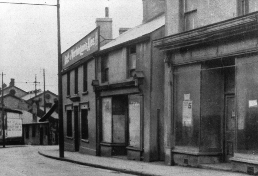
| The
Oxford Hotel, Sand Street. |
|
|
|
| |
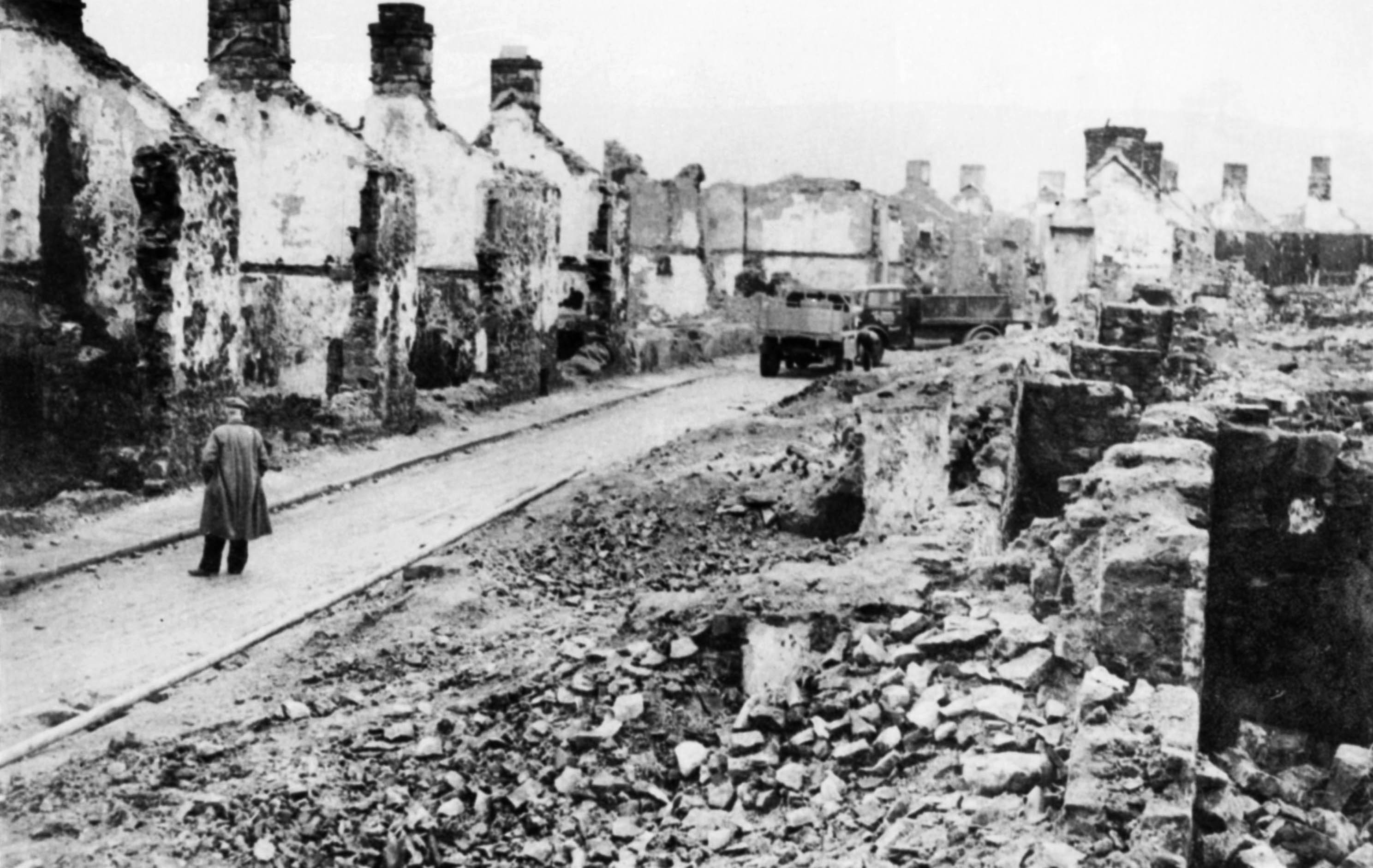
|
Demolition of Sand Street, Dowlais 1935.
|
|
 |
| |
|
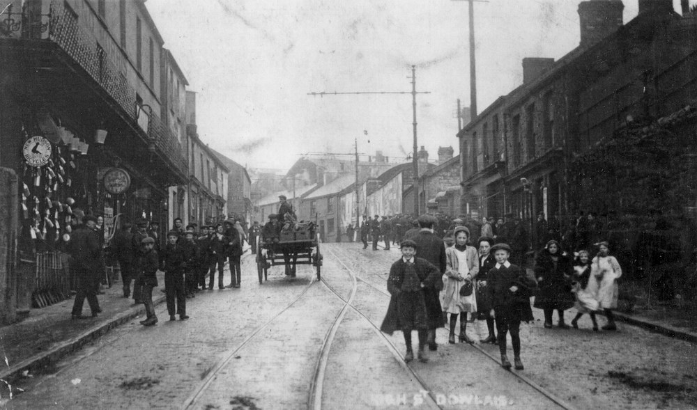
Dowlais - High Street
(Photograph
Courtesy of David Thomas) |
|
 |
| |
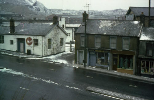
| High Street. |
|
| |
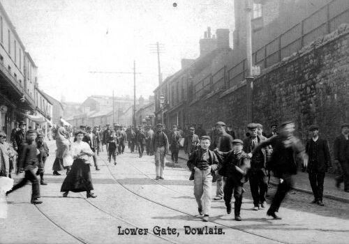
|
High Street , Lower Gate. |
|
 |
| |
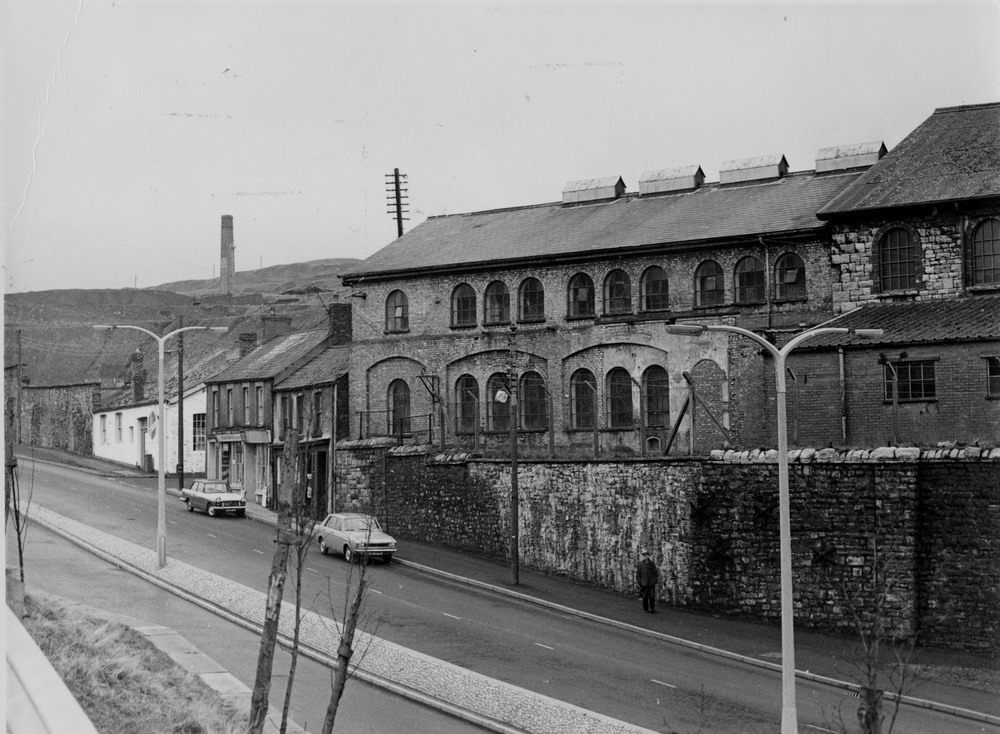
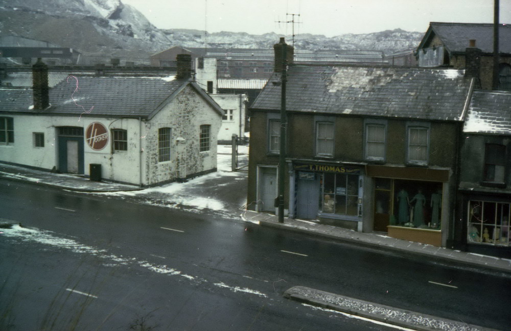
Same Place, from a different angle in the 1960s.
Hoover occupied the factory when this photograph was taken, but it was at one time B.S.A. Guns. Originally it was the Dowlais works railway station and the termination of the Dowlais Railway line. |
|
| |
| |
Hoover Dowlais Entrance, 1970s, the old Dowlais
Works Lower Gate entrance. |
|
|
|
| |
 |
|
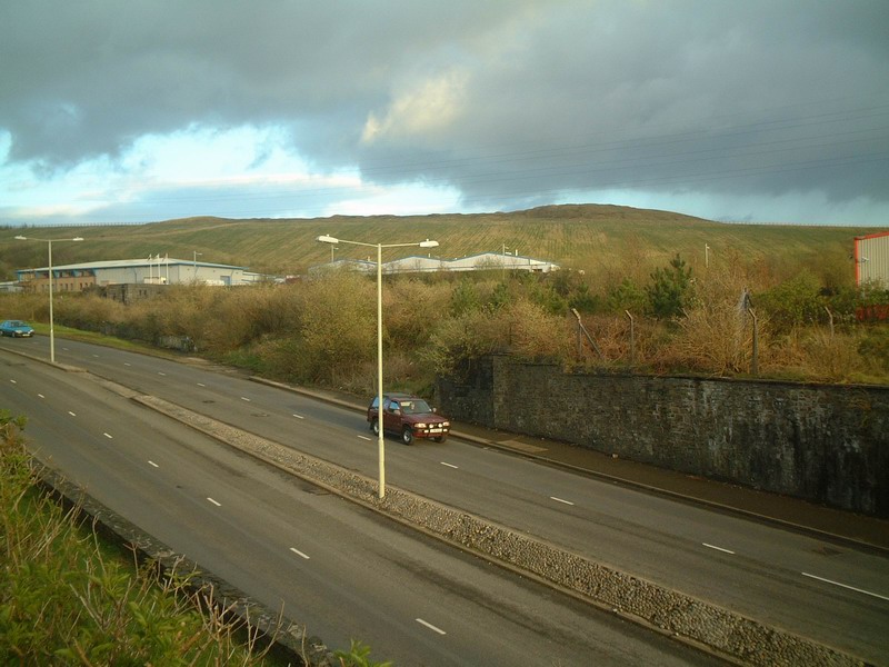
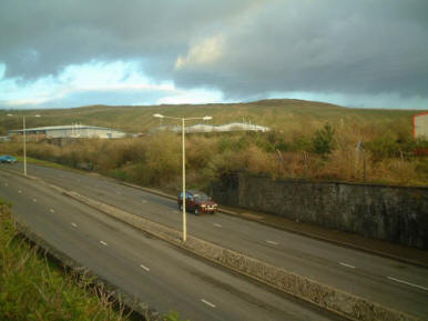
The Same Scene as above
taken in 2002
(Photograph:
Alan George - Old Merthyr Tydfil) |
|
 |
|
| |
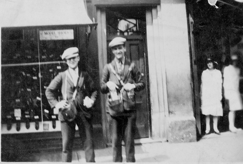
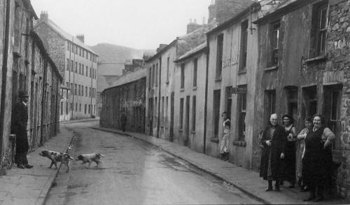
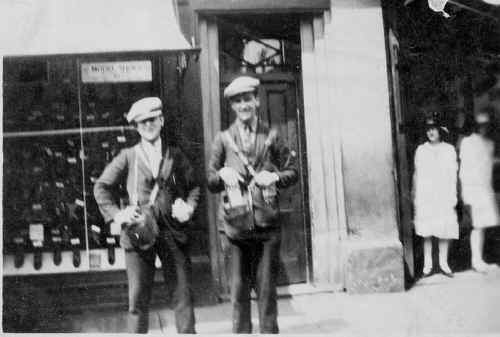
| Busmen at High Street ,Lower
Gate (Photograph courtesy of Miss Ballam) |
|
 |
| |
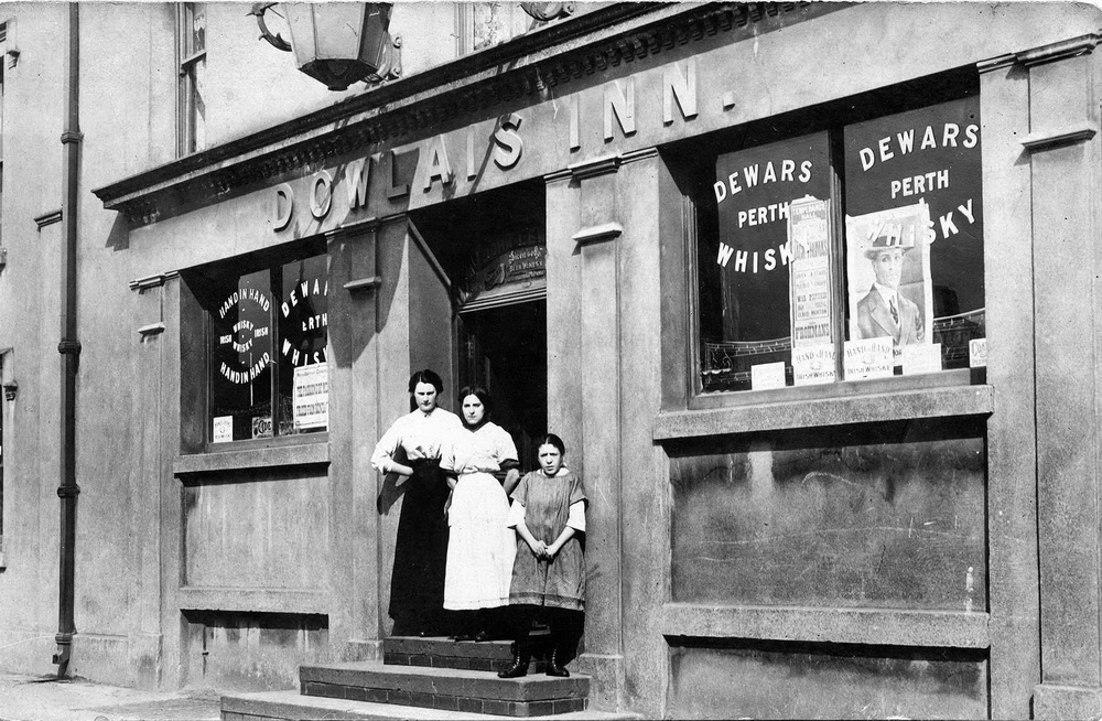
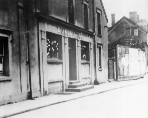
|
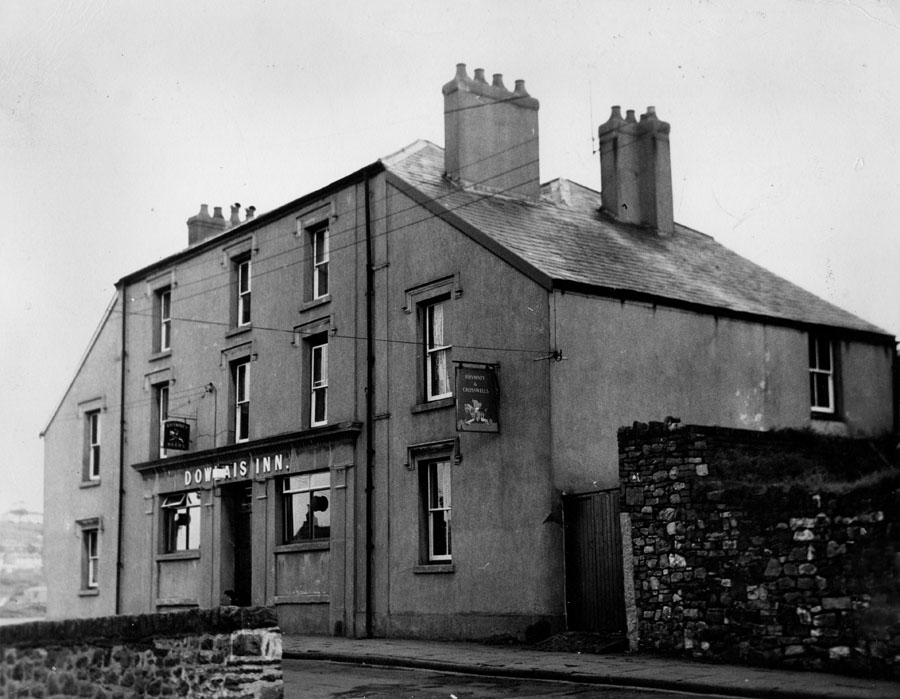
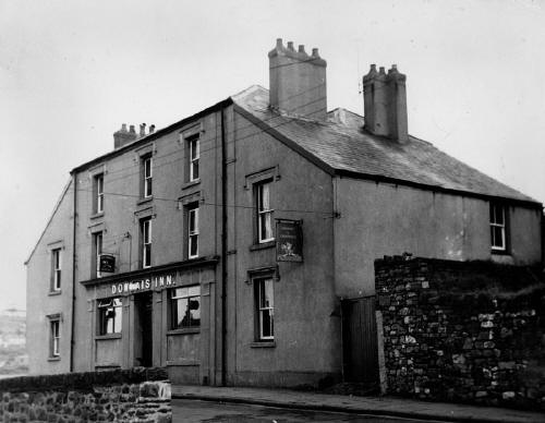
The Dowlais Inn. |
|
 |
|
|
|
Dowlais Inn
(Photograph
courtesy of Peter Noyce) |
|
 |
|
|
|
|
The Dowlais Inn.
(Photograph
courtesy of the John Owen Collection) |
|
 |
|
Dowlais Lower High Street, by
the Dowlais Inn, 1938.
(Photograph
courtesy of the John Owen Collection) |
|
 |
|
|
Dowlais. Top of the New Road
outside Barum House.
Lower Gate in background.
(Photograph courtesy of Miss Ballam) |
|
 |
| |
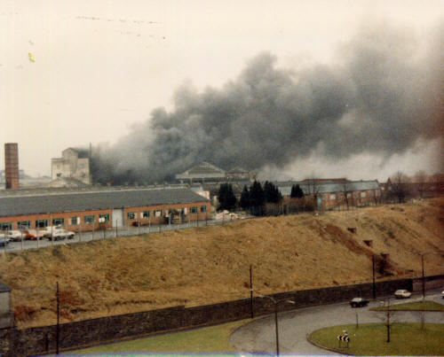
|
This photograph taken in the
1980s, from the Dowlais Flats, shows the fire which destroyed Croda
Packaging (Goat Mill Road).
(Photograph
Courtesy of Richard Hicks) |
|
 |
| |
| Dowlais Flats - 1960's |
|
| |
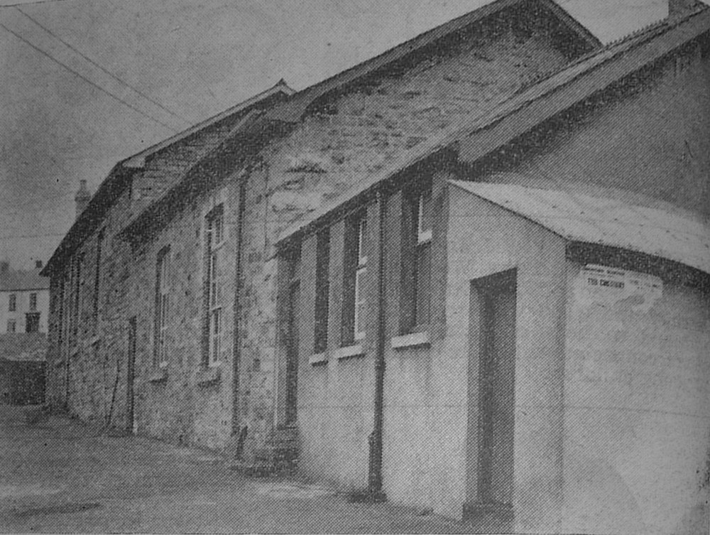
|
The Welfare Clinic, At the
rear of the top of the New Road.
This was the first building to be
constructed as a Clinic in the Borough. |
|
 |
| |
|
Click Here
to visit the
Plough School |
|
| |
|
Top of the
New Road, Baram House, home to the Ballam family.
At one time an
ironmongers shop.
(Photograph
courtesy of Miss Ballam.) |
|
 |
| |
| The New Road in the early 1900s. |
|
 |
| |
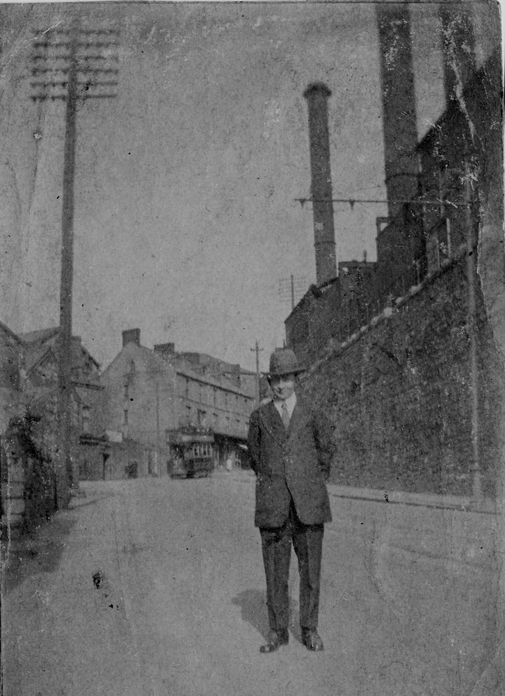
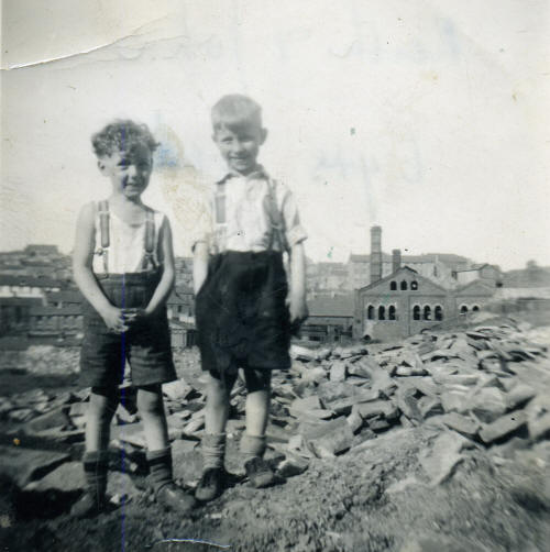
|
Keith Watts
(left) and friend on the New Road, Dowlais
In the background is
the Dowlais Gas Works, looking over the Bont |
|
 |
| |
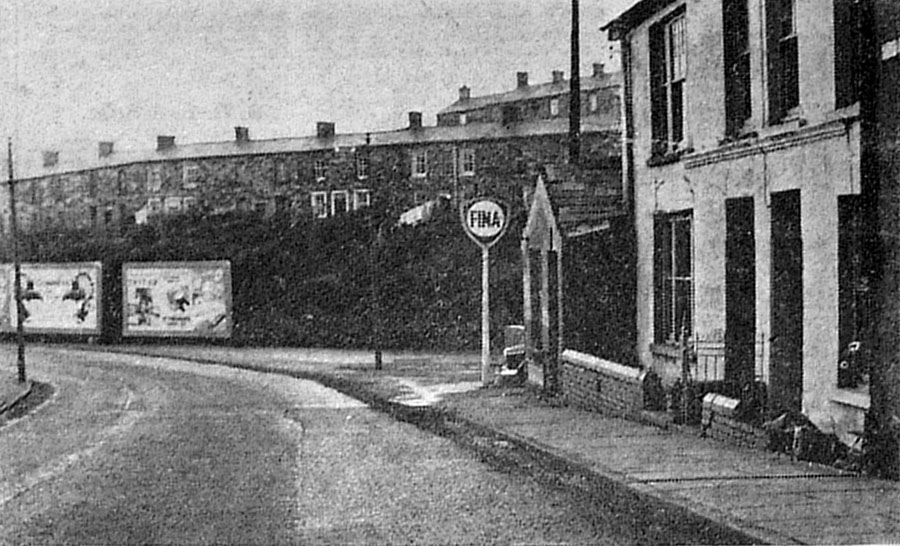
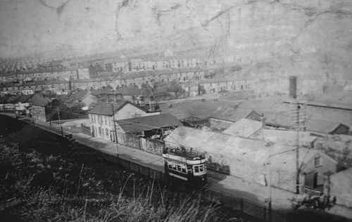
| The bottom of the New Road in the 1960s. |
|
| |
| Dowlais - During Re-development -
Late 1970's |
|
 |
| |
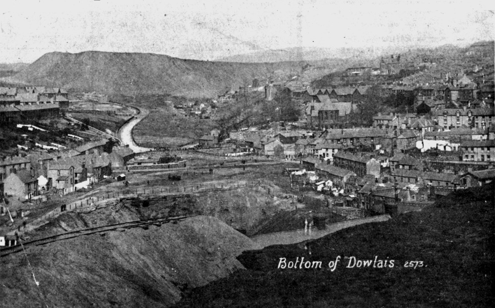
|
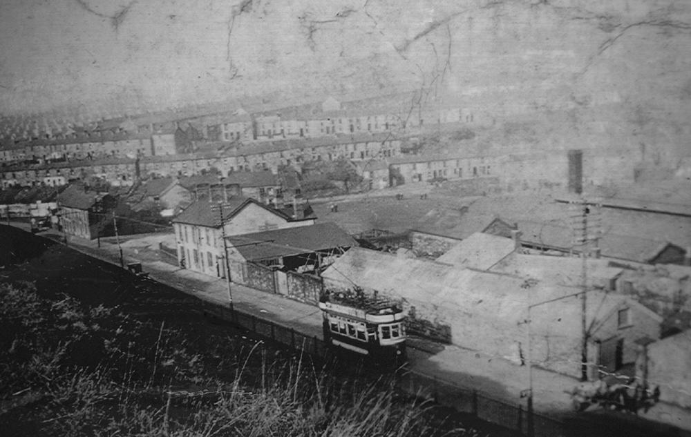
Bottom Of Dowlais.
|
|
 |
| |
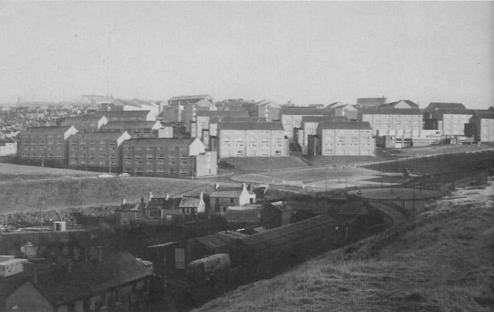
|
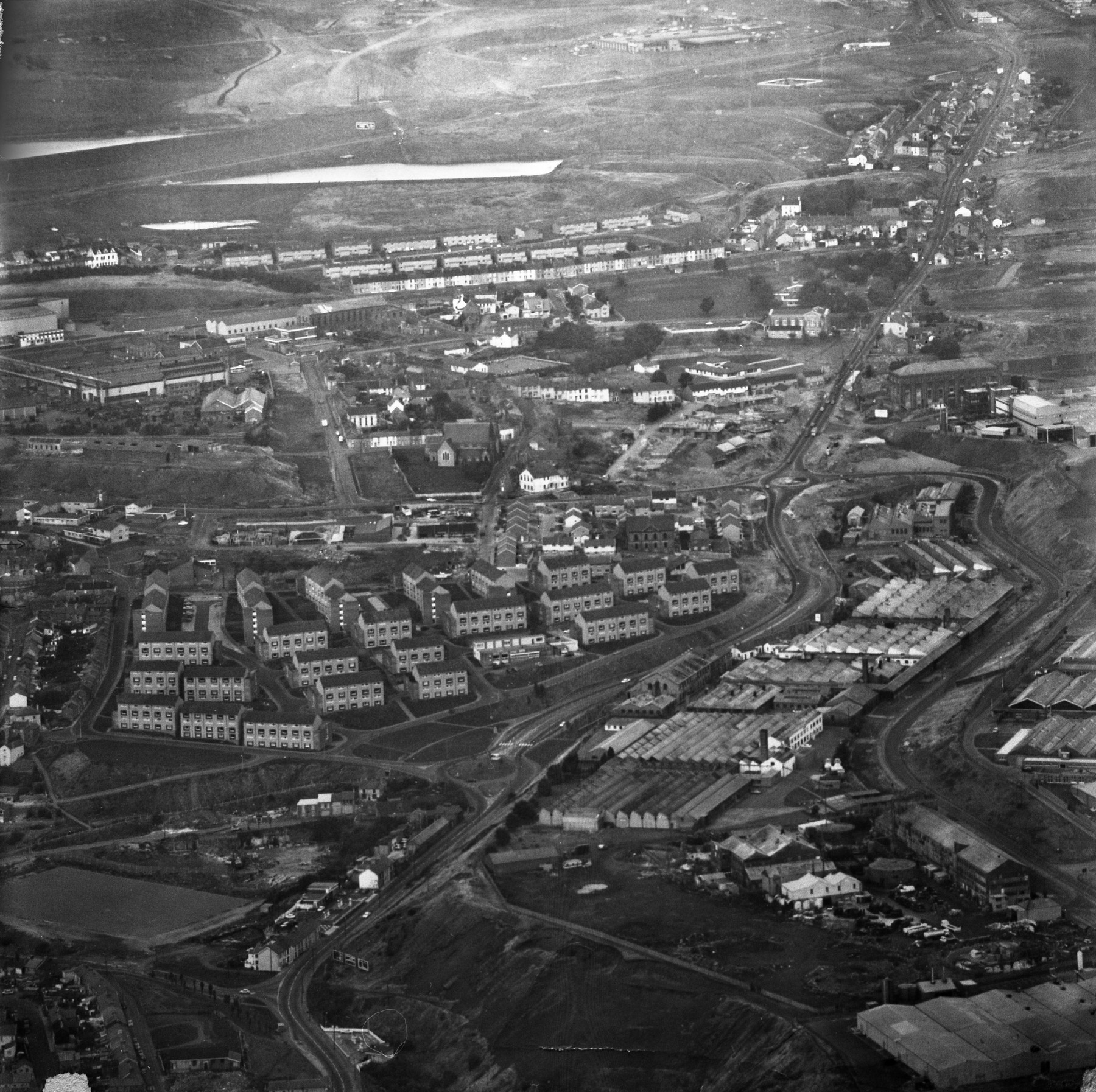
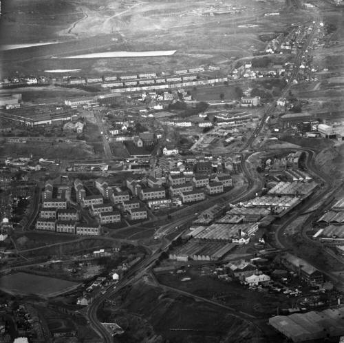
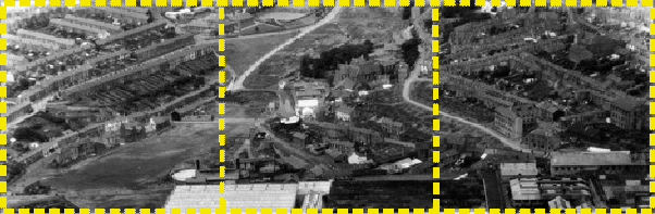
Upper Penydarren - The Bont -
Lower Dowlais - 1951.
(Please click on the section you
wish to enlarge) |
|
 |
| |
|
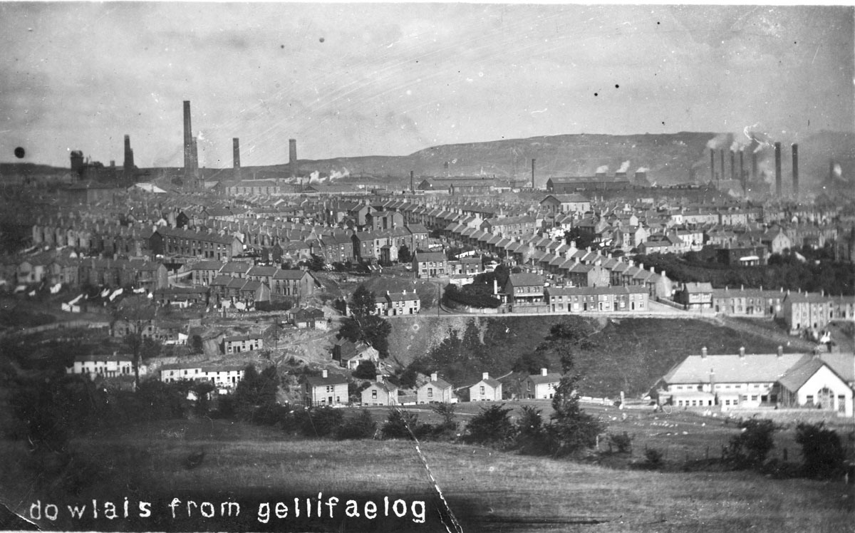
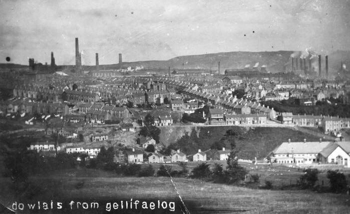
Dowlais from Gellifaelog
An early photograph looking
across to Dowlais from Gellifaelog, in the foreground can be seen, the Rocky
Road,
Gellifaelog School. To the
left, the Cwm, in the middle, Balaclava Road and above most of Dowlais. The
Ivor Works
is shown top left and the
Great Dowlais Works is extreme, top right.
<Click the
enlarge> |
|
 |
|
|
|
|
|
|
|
Do you
have any photographs or information relating to Dowlais, Merthyr Tydfil?
If so, please contact us, by clicking the 'Contact Us' button.
|
| |
|
 |
|
 |