|
Taf Fechan Reservoir |
|
Merthyr Tydfil |
| |
| |
|
The Taf Fechan gathering ground, an
area of 8,351 acres, extends
from the highest point of the Breconshire Beacons (Pen-y-fan, 2,907 ft. above
sea level) in a southerly direction to the reservoir embankment at
Pontsticill.
The rainfall on the catchment
area averages 72.86 inches at the Neuadd Reservoirs and
about five miles south, 58.72 inches at Taf Fechan
Reservoir. The rainfall drains off the mountainside to the valley
and is impounded in three reservoirs.
The first reservoir
constructed for the supply of Merthyr Tydfil, was Pentwyn Reservoir
(known locally as Dolygaer Lake) under an act obtained
by the Merthyr Local Board of Health. in 1858.
The Pentwyn Reservoir was
combined into the Taf Fechan reservoir which was completed in 1927. |
|
|
|
|
|
|
<Click on the image
to enlarge> |
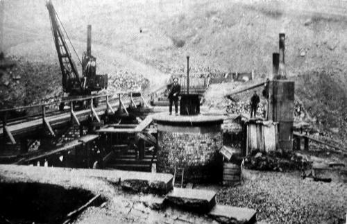
| Constructing the Pentwyn Reservoir in 1858. |
|
 |
| |
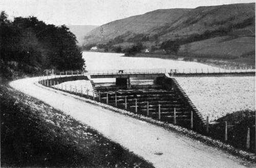
| The Embankment of the Pentwyn Reservoir. |
|
 |
|
|
|
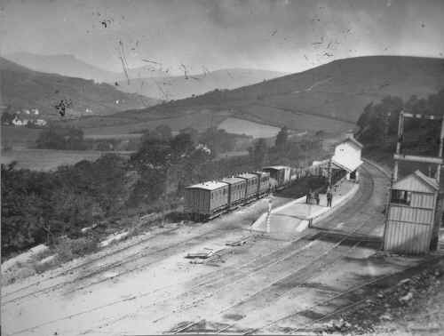
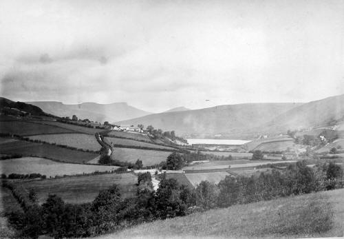
Before the Reservoir
This photograph taken by
the Ironmaster Robert T. Crawshay in the 1870's shows
the area aside the Pontsticill
Junction Railway Station prior to the reservoir
being built. |
|
 |
| |
|
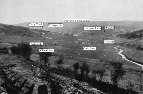
Showing the area to be
impounded,
and the layout of the properties,
some were soon to flooded by the Taff Fechan reservoir. |
|
 |
|
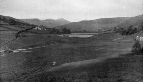
Looking towards the Dam of the Pentwyn
Reservoir before the impounding of the Taff Fechan Reservoir, Pen-y-fan
2,907ft in the distance. |
| This photograph from the 1870s by Robert
Thompson Crawshay shows the Pentwyn Inn on the left of the
embankment and Dolygaer Farm on the extreme right. |
|
This later photograph from the early 1920s shows middle left
hand side the Taff Fechan Bridge, then the Pentwyn Inn, the
reservoir embankment, and on the right Cae'r Farm |
|
| |
 |
|
 |
|
|
| |
| |
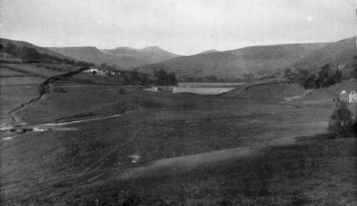
| Looking towards the Dam of the Pentwyn
Reservoir before the impounding of the Taff Fechan Reservoir, Pen-y-fan
2,907ft in the distance. |
|
 |
| |
|
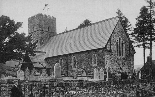
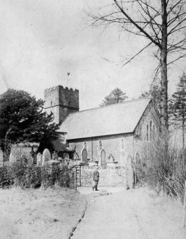
Dolygaer Church. Now lying
beneath the waters of the reservoir.
(postcard courtesy
of the Leo Davies collection) |
|
  |
| |
|
Dolygaer Farm,
The family are shown here,
outside the farm building during the last years before the valley was
flooded. |
|
_small.jpg) |
| |
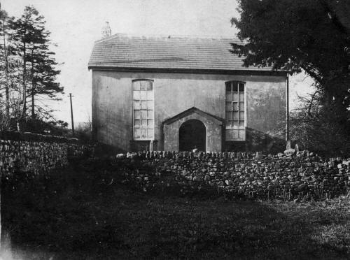
| Bethlehem Congregational Chapel. Built 1828 |
| |
 |
|
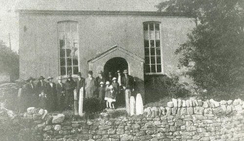
Farewell meeting September 14th 1925. |
|
 |
|
|
|
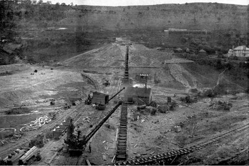
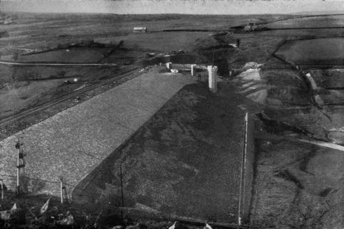
| The Construction of the Taff Fechan
Reservoir. |
|
|
|
|
|
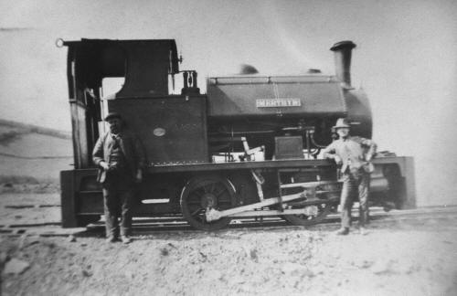
Loco 'Merthyr' used on the construction of the reservoir. |
|
 |
| |
| Looking East, the embankment during
construction |
|
 |
| Looking West, the embankment before
impounding. |
|
 |
|
|
|
These two photographs were taken during the construction of the
Reservoir in the 1920's. |
|
|
|
| |
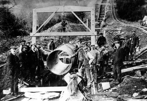
| Constructing the Pipeline that took the water down to
Merthyr. |
|
 |
| |
|
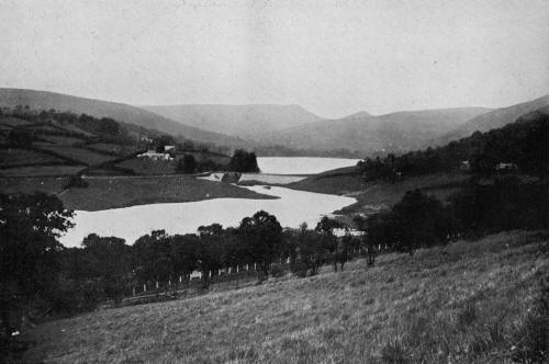
Looking towards the Dam of the Pentwyn
Reservoir after the impounding of the Taff Fechan Reservoir,
Dolygaer Station can be seen on the
extreme right. |
|
 |
| |
| Taff Fechan Reservoir after impounding had
began - 1927 |
|
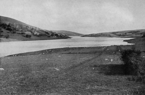 |
| |
|
Taff Fechan
Reservoir. Work on the reservoir commenced in 1913, but ceased at the
outbreak
of World War
1, it was completed and opened in 1927. |
|
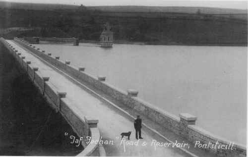 |
| |
|
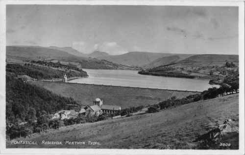
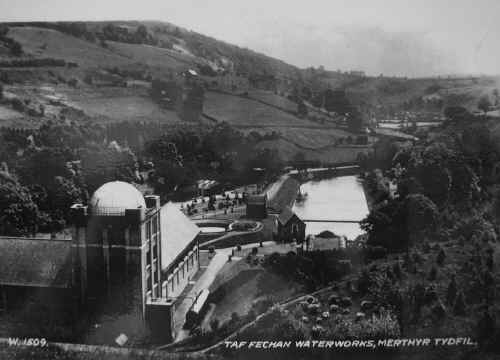
Pontsticill Reservoir - This
shows the Taf Fechan Waterworks that filters
the water before it goes into
the supply system - postcard courtesy of Viv Bayliss.
|
|
 |
|
| Taff Fechan Waterworks - 1927. |
|
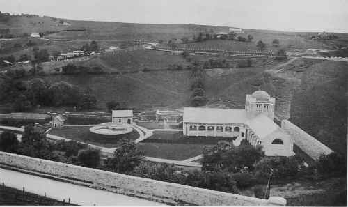 |
|
| Taf Fechan Waterworks. |
|
 |
| |
|
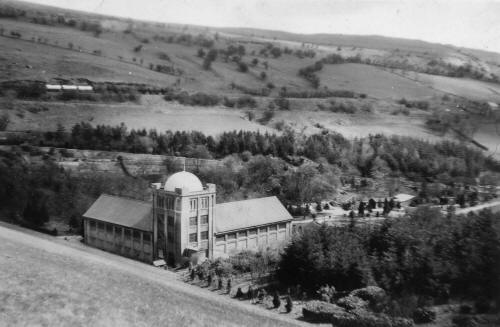
Taf Fechan Waterworks
View from the dam over the
waterworks
(Photograph
Courtesy of Colin Markham) |
|
 |
| |
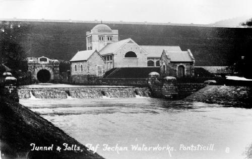
| Taff Fechan Waterworks, Tunnel
and Falls. |
|
 |
|
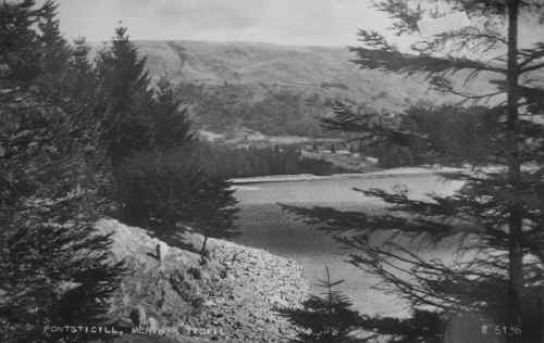
| The Reservoir. |
|
 |
|
|
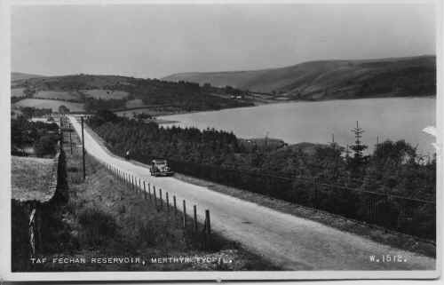
Taff Fechan Reservoir. - Postcard
courtesy of The Leo Davies Collection.
|
|
 |
|
|
|
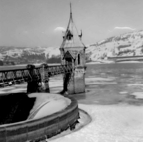
Taff Fechan Reservoir Frozen
- Winter 1962/63
(Photograph
courtesy of Robert Fraser) |
|
 |
|
|
|
Princess Margaret opens the
new Filtration Plant, 1971
(Photographs
by Cei Robins
courtesy of David Robins) |
|
|
|
|
|
|
|
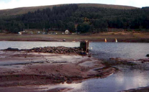
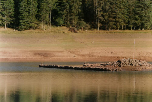
Everytime there is a
drought, the porch to the 'old chapel' can be seen.
This photograph from the early
1980's was sent in by Phil Evans. |
|
 |
|
|
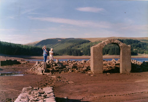
| These photographs show the drought of the early
1980s. |
|
|
|
|
|
Young Lisa and Stephen
Evans are seen here near the Entrance arch to the old Bethlehem
Chapel.
(Photographs courtesy of Raymond 'Blondie' Evans) |
|
|
|
| |
 |
|
 |
|
|
|
|
|
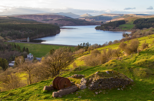
Taf Fechan Reservoir from
the Baltic Quarry, in 2014
(Photograph
courtesy of Richard Hooper) |
|
 |
|
|
|
Click Here for the Lower Neuadd Reservoir |
|
Click Here for the
Upper Neuadd Reservoir |
| |
|
Do you
have any photographs or information for this page?
If so,
please email us, by clicking the 'Contact Us' button. |
| |
|
|

To
Pontsticill |

To
Page Index |

To
Pontsticill
Station
|
|
|
|
 |
|
|