![]()
![]()
![]()
![]()
![]()
![]()
|
Caepantywyll |
|||||||||
|
Merthyr Tydfil |
|||||||||
|
|||||||||
|
<Click on images to enlarge> |
|||||||||
|
|||||||||
|
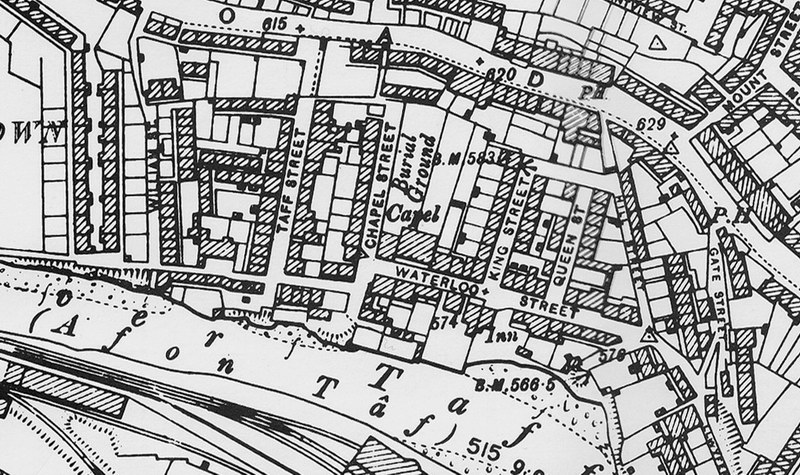
Extract from the 1989 Ordnance Survey Map - Merthyr Tydfil North and South available on PC-CD ROM from our shop. |
|||||||||
|
|
|||||||||
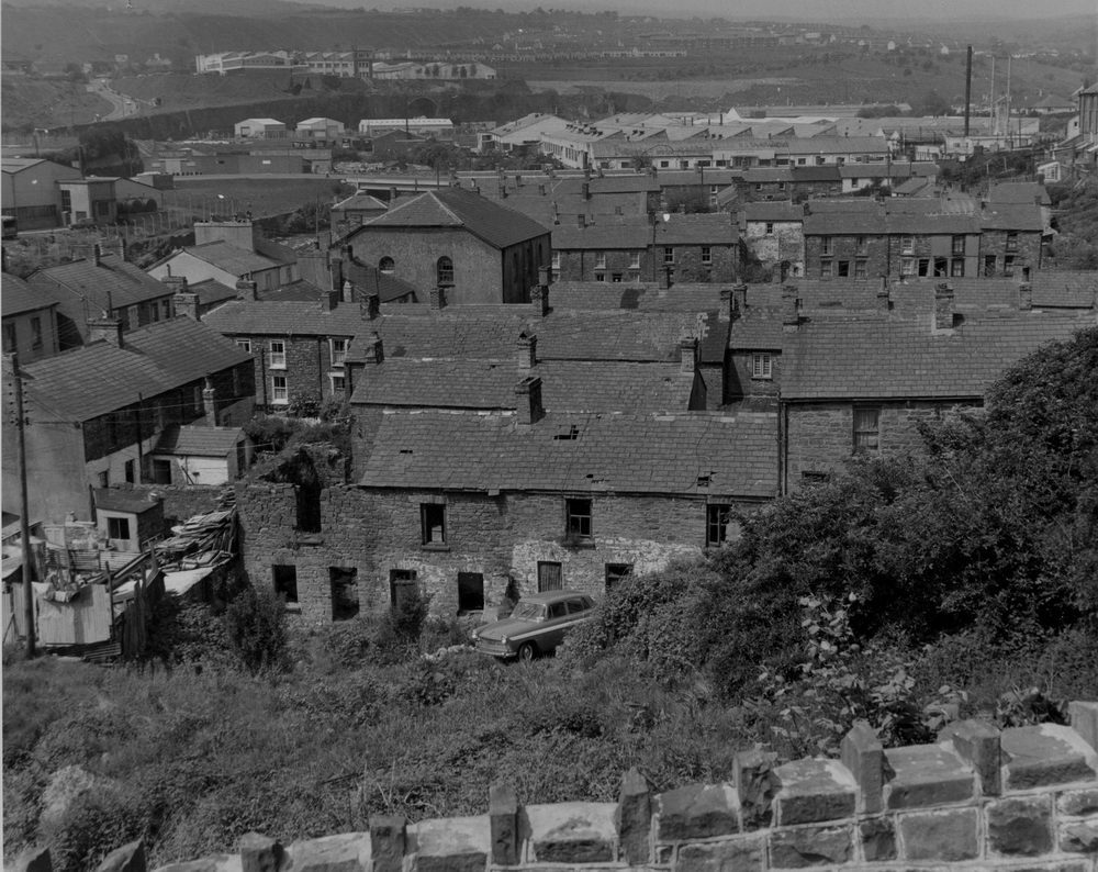
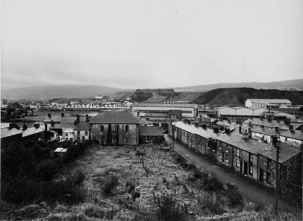
| Caepantywyll, taken from the Cyfarthfa Tip, | |||||||||
|
|
|||||||||
|
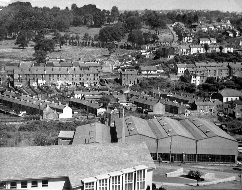
Caepantywyll, taken from the Brecon Road, In the distance you can see Lines Bros, (Triang Toys), Thorn, and Gellideg Estate. |
|||||||||
|
|
|||||||||
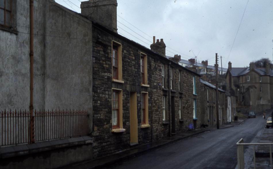
| Quarry Row | |||||||||
|
|
|||||||||
|
The Eagle Inn, Quarry Row - c1900 James James is wearing the Bowler Hat. He was Landlord of the Eagle Inn, his son John James ran the John James Removal and Haulage Business which was based at the rear the pub. (Photograph courtesy of Tim Morgan, John James' Great Grandson, Ex of Tudor Street) |
|||||||||
|
|||||||||
|
The Castle Inn (Photograph Courtesy of Val Griffiths) |
|||||||||
|
|
|||||||||
|
|
|||||||||
|
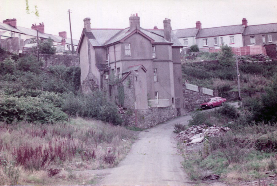
The Castle Inn - 1978 (Photograph Courtesy of Dez Broome) |
|||||||||
|
|
|||||||||
|
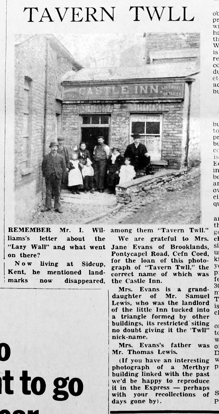
The Castle Inn - 'Tavern Twll' Geoff Matsell says that the present Castle Inn was rebuilt sometime in the past, and the original 'Tavern Twll' is part of the cellar of the new building. (Thanks to Ian Gravell, Mervyn Davies, John Smith, Gary Evans & Geoff Matsell for responding to our request for help with this photograph.) |
|||||||||
|
|
|||||||||
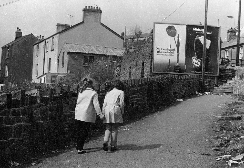
| Caepantywyll - Path to Brecon Road at the side of the Tavern Twll | |||||||||
|
|||||||||
|
Waterloo Street (Photograph courtesy of the Leo Davies Collection) |
|||||||||
|
|
|||||||||
| Waterloo Street - Caepantywyll | |||||||||
|
|
|||||||||
| Chapel Street and Chapel | |||||||||
|
|
|||||||||
|
Waterloo Street and Bethlehem Chapel (Photograph courtesy of Dr T. F. Holley) |
|||||||||
|
|
|||||||||
|
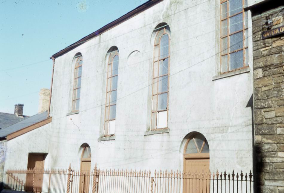
Bethlehem Chapel, Waterloo Street (Photograph courtesy of the Leo Davies Collection) |
|||||||||
|
|||||||||
|
|
|||||||||
| At the Junction of Chapel St & Waterloo Street | |||||||||
|
|
|||||||||
|
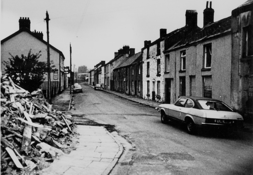
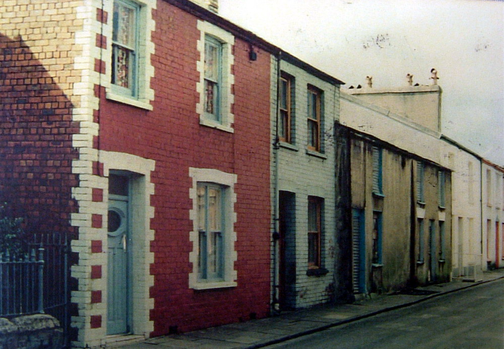
Waterloo Street - 1978 (Photograph courtesy of Dez Broome) |
|||||||||
|
|
|||||||||
|
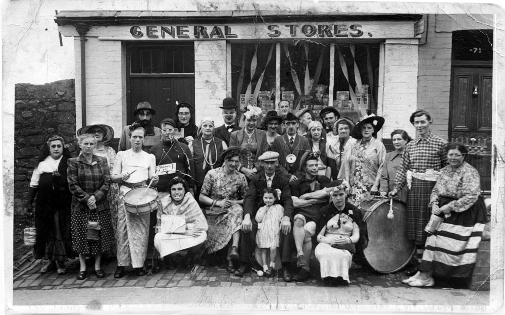
VE day Street Party outside The General Stores, Waterloo Street. The only names we have at the moment are:- 1st Left: Cissy Frangetti and 2nd from the right, Tom Bennett (the guy in the kilt), Annie Evans. (Photograph courtesy of Phil Harrison, the Quar) |
|||||||||
|
|
|||||||||
|
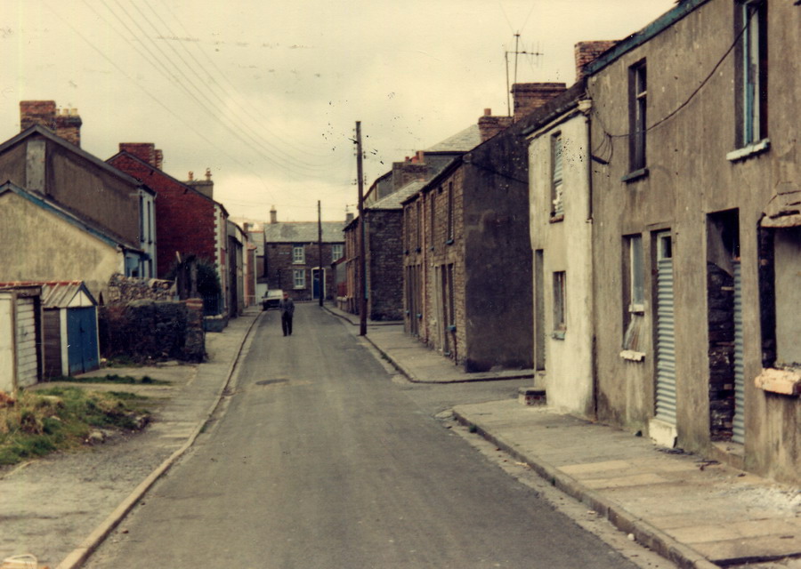
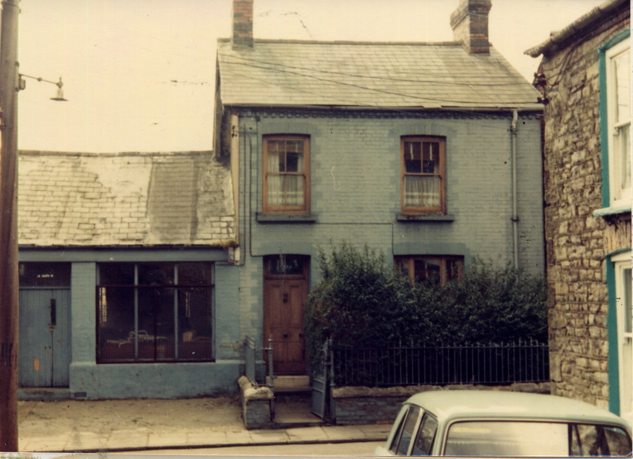
Looking From King Street, 1978 General Stores closed now (Photograph courtesy of Dez Broome) |
|||||||||
|
|
|||||||||
|
Do you have any photographs or information relating to Caepantywyll, Merthyr Tydfil? If so, please contact us by clicking the 'Contact Us' button. |
|||||||||
|
Go To:
|
|||||||||
|
To The Map |
|||||||||
|
|
|||||||||